 vesseltracker.com
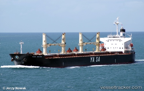
 AKIJ MOON
Current Status
Where is the vessel?
AKIJ MOON is currently in 100 nm SW of Mul Dwårka, based on AIS data received about 2h ago.
Latest AIS update:
Current position: 19.22468° N, 69.96560° E (100 nm SW of Mul Dwårka)
Average speed (last 7 days): Loading…
Average speed (last 30 days): Loading…
Vessel profile: AKIJ MOON is a Bulk Carrier with dimensions 32m x 190m.
This page combines live AIS, route history, probable destination signals, nearby traffic, and port activity for practical vessel monitoring.
The current position of vessel AKIJ MOON is 19.22468 lat / 69.96560 lng. Updated: 2026-05-15 00:59:58 UTCNearest reference points:
- 33 nm S of Mul Dwårka
- Near Jafarabad
- 17 nm SE of Port Pipavav
Currently sailing under the flag of Bangladesh ![]()
AKIJ MOON built in 2005 year
Deadweight:
55953 tDetails:
Live Vessel AKIJ MOON Analytics (details, animations, etc.)
Recent AIS points (UTC):
2026-05-14 21:33:50 UTC · 19.74791, 69.59828 · SOG 10.9 kn · COG 143°2026-05-14 23:01:09 UTC · 19.52870, 69.75830 · SOG 10.9 kn · COG 144°
2026-05-14 23:52:58 UTC · 19.39575, 69.84738 · SOG 10.9 kn · COG 147°
2026-05-15 00:59:58 UTC · 19.22468, 69.96560 · SOG 10.9 kn · COG 152°