 vesseltracker.com
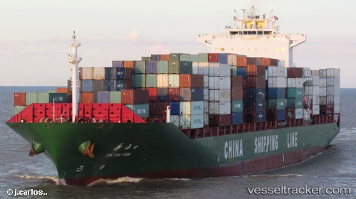
 Xin Hai Kou
Current Status
Where is the vessel?
Xin Hai Kou is currently in Near Fujairah, based on AIS data received about 3d ago.
Latest AIS update:
Current position: 25.24746° N, 56.46156° E (Near Fujairah)
Average speed (last 7 days): Loading…
Average speed (last 30 days): Loading…
Vessel profile: Xin Hai Kou is a Container Ship with dimensions 263m x 32m.
This page combines live AIS, route history, probable destination signals, nearby traffic, and port activity for practical vessel monitoring.
The current position of vessel Xin Hai Kou is 25.24746 lat / 56.46156 lng. Updated: 2026-05-11 04:30:02 UTCNearest reference points:
- Near Fujairah
- Near KHORFAKKAN
- Near Offshore Fujairah
Currently sailing under the flag of China ![]()
Xin Hai Kou built in 2005 year
Deadweight:
52212 tDetails:
Live Vessel Xin Hai Kou Analytics (details, animations, etc.)
Recent AIS points (UTC):
2026-05-11 04:30:02 UTC · 25.24746, 56.46156 · SOG 0.5 kn · COG 34°2026-05-11 04:30:02 UTC · 25.24746, 56.46156 · SOG 0.5 kn · COG 34°
2026-05-11 04:30:02 UTC · 25.24746, 56.46156 · SOG 0.5 kn · COG 34°
2026-05-11 04:30:02 UTC · 25.24746, 56.46156 · SOG 0.5 kn · COG 34°