 vesseltracker.com
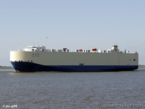
 Chang Tai Hong
Current Status
Where is the vessel?
Chang Tai Hong is currently in 85 nm SE of Shidao Pt, based on AIS data received less than 1h ago.
Latest AIS update:
Current position: 35.63542° N, 123.31380° E (85 nm SE of Shidao Pt)
Average speed (last 7 days): Loading…
Average speed (last 30 days): Loading…
Vessel profile: Chang Tai Hong is a Vehicles Carrier with dimensions 176m x 31m.
This page combines live AIS, route history, probable destination signals, nearby traffic, and port activity for practical vessel monitoring.
The current position of vessel Chang Tai Hong is 35.63542 lat / 123.31380 lng. Updated: 2026-05-14 21:24:01 UTCNearest reference points:
- 83 nm SE of Shidao Pt
- 78 nm SE of Shidao Pt
- 67 nm SE of Shidao Pt
Currently sailing under the flag of China ![]()
Chang Tai Hong built in 2009 year
Deadweight:
12282 tDetails:
Live Vessel Chang Tai Hong Analytics (details, animations, etc.)
Recent AIS points (UTC):
2026-05-14 17:39:14 UTC · 36.52628, 123.30515 · SOG 13.9 kn · COG 180°2026-05-14 19:31:00 UTC · 36.08847, 123.31692 · SOG 14.3 kn · COG 180°
2026-05-14 19:54:13 UTC · 35.99577, 123.31675 · SOG 14.2 kn · COG 179°
2026-05-14 21:24:01 UTC · 35.63542, 123.31380 · SOG 14.5 kn · COG 177°