 vesseltracker.com
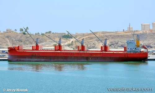
Jag Radha
Current StatusWhere is the vessel?
Jag Radha is currently in 17 nm W of Palghar, based on AIS data received less than 1h ago.
Latest AIS update:
Current position: 19.72612° N, 72.45670° E (17 nm W of Palghar)
Average speed (last 7 days): Loading…
Average speed (last 30 days): Loading…
Vessel profile: Jag Radha is a Bulk Carrier with dimensions 32m x 190m.
This page combines live AIS, route history, probable destination signals, nearby traffic, and port activity for practical vessel monitoring.
The current position of vessel Jag Radha is 19.72612 lat / 72.45670 lng. Updated: 2026-05-14 23:53:06 UTCNearest reference points:
- Near HNB SEZ/Mumbai
- Near Mumbai
- Near NHAVA SHEVA
Details:
Live Vessel Jag Radha Analytics (details, animations, etc.)
Recent AIS points (UTC):
2026-05-14 20:01:56 UTC · 19.16231, 72.48246 · SOG 9.6 kn · COG 356°2026-05-14 21:34:07 UTC · 19.39734, 72.44600 · SOG 8.6 kn · COG 0°
2026-05-14 23:00:57 UTC · 19.60232, 72.46063 · SOG 8.4 kn · COG 8°
2026-05-14 23:53:06 UTC · 19.72612, 72.45670 · SOG 8.5 kn · COG 4°