 vesseltracker.com
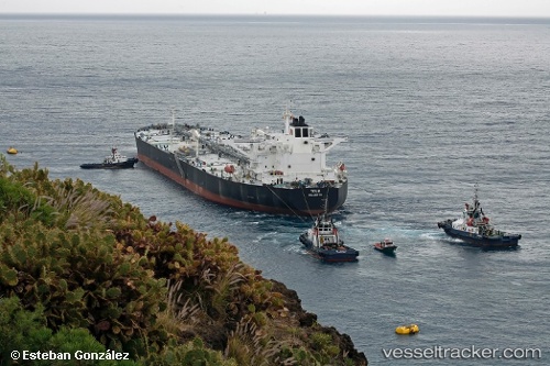
Tour 2
Current StatusWhere is the vessel?
Tour 2 is currently in 35 nm NE of PENGERANG, based on AIS data received about 2h ago.
Latest AIS update:
Current position: 1.67244° N, 104.64227° E (35 nm NE of PENGERANG)
Average speed (last 7 days): Loading…
Average speed (last 30 days): Loading…
Vessel profile: Tour 2 is a Crude Oil Tanker with dimensions 48m x 274m.
This page combines live AIS, route history, probable destination signals, nearby traffic, and port activity for practical vessel monitoring.
The current position of vessel Tour 2 is 1.67244 lat / 104.64227 lng. Updated: 2026-04-29 21:25:44 UTCNearest reference points:
- 34 nm NE of PENGERANG
- 38 nm E of PENGERANG
- 45 nm NE of PENGERANG
Details:
Live Vessel Tour 2 Analytics (details, animations, etc.)
Recent AIS points (UTC):
2026-04-29 19:31:45 UTC · 1.67298, 104.64307 · SOG 0 kn · COG -1°2026-04-29 19:49:47 UTC · 1.67297, 104.64294 · SOG 0 kn · COG -1°
2026-04-29 21:25:44 UTC · 1.67244, 104.64227 · SOG 0 kn · COG -1°
2026-04-29 21:25:44 UTC · 1.67244, 104.64227 · SOG 0 kn · COG -1°