 vesseltracker.com
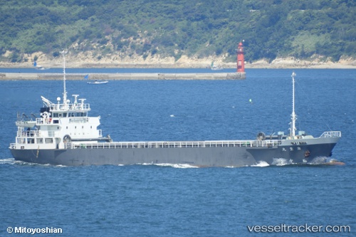
 Kaihoumaru
Current Status
Where is the vessel?
Kaihoumaru is currently in Near Sensyu, based on AIS data received less than 1h ago.
Latest AIS update:
Current position: 34.42598° N, 135.16573° E (Near Sensyu)
Average speed (last 7 days): Loading…
Average speed (last 30 days): Loading…
Vessel profile: Kaihoumaru is a General Cargo Ship with dimensions 74m x 12m.
This page combines live AIS, route history, probable destination signals, nearby traffic, and port activity for practical vessel monitoring.
The current position of vessel Kaihoumaru is 34.42598 lat / 135.16573 lng. Updated: 2026-05-01 01:48:27 UTCNearest reference points:
- Near KADA
- Near Hyogo
- Near Awaji
Currently sailing under the flag of Japan ![]()
Details:
Live Vessel Kaihoumaru Analytics (details, animations, etc.)
Recent AIS points (UTC):
2026-04-30 23:04:06 UTC · 34.58927, 135.46257 · SOG 0 kn · COG 272°2026-05-01 00:15:56 UTC · 34.59388, 135.42200 · SOG 11.7 kn · COG 296°
2026-05-01 01:38:27 UTC · 34.45302, 135.18633 · SOG 11.5 kn · COG 218°
2026-05-01 01:48:27 UTC · 34.42598, 135.16573 · SOG 11.7 kn · COG 204°