 vesseltracker.com
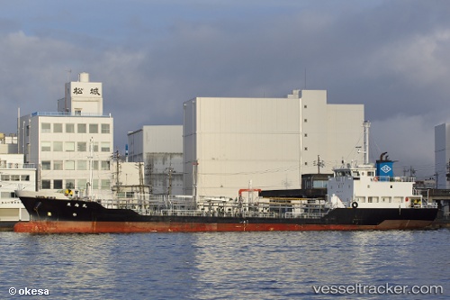
Tounan Maru
Current StatusWhere is the vessel?
Tounan Maru is currently in Near Hakodate, based on AIS data received less than 1h ago.
Latest AIS update:
Current position: 41.79379° N, 140.72482° E (Near Hakodate)
Average speed (last 7 days): Loading…
Average speed (last 30 days): Loading…
Vessel profile: Tounan Maru is a Chemical Tanker with dimensions 11m x 72m.
This page combines live AIS, route history, probable destination signals, nearby traffic, and port activity for practical vessel monitoring.
The current position of vessel Tounan Maru is 41.79379 lat / 140.72482 lng. Updated: 2026-04-24 19:37:05 UTCNearest reference points:
- Near Muroran
- 23 nm NE of SAI
- 11 nm NW of Yokohama, Aomori
Details:
Live Vessel Tounan Maru Analytics (details, animations, etc.)
Recent AIS points (UTC):
2026-04-24 16:22:04 UTC · 41.79374, 140.72482 · SOG 0 kn · COG 67°2026-04-24 18:10:02 UTC · 41.79382, 140.72485 · SOG 0 kn · COG 67°
2026-04-24 19:01:07 UTC · 41.79380, 140.72485 · SOG 0 kn · COG 67°
2026-04-24 19:37:05 UTC · 41.79379, 140.72482 · SOG 0 kn · COG 67°