 vesseltracker.com
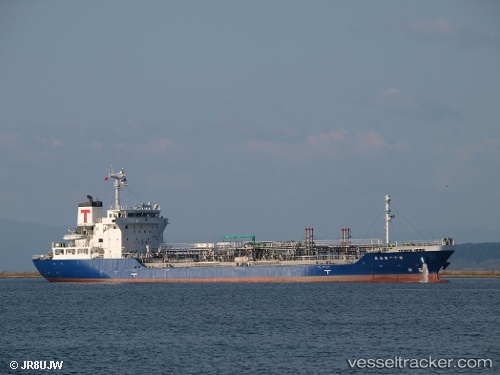
Kirishima Maru No.11
Current StatusWhere is the vessel?
Kirishima Maru No.11 is currently in 12 nm N of Kashima Ko, based on AIS data received less than 1h ago.
Latest AIS update:
Current position: 36.16532° N, 140.77278° E (12 nm N of Kashima Ko)
Average speed (last 7 days): Loading…
Average speed (last 30 days): Loading…
Vessel profile: Kirishima Maru No.11 is a Oil Products Tanker with dimensions 16m x 104m.
This page combines live AIS, route history, probable destination signals, nearby traffic, and port activity for practical vessel monitoring.
The current position of vessel Kirishima Maru No.11 is 36.16532 lat / 140.77278 lng. Updated: 2026-05-02 10:08:15 UTCNearest reference points:
- Near Mito
- Near KASHIMA
- 12 nm E of CHOSHI
Details:
Live Vessel Kirishima Maru No.11 Analytics (details, animations, etc.)
Recent AIS points (UTC):
2026-05-02 01:49:57 UTC · 35.97551, 140.71202 · SOG 10.9 kn · COG 195°2026-05-02 01:49:57 UTC · 35.97551, 140.71202 · SOG 10.9 kn · COG 195°
2026-05-02 10:03:34 UTC · 36.14721, 140.76648 · SOG 14.3 kn · COG 18°
2026-05-02 10:08:15 UTC · 36.16532, 140.77278 · SOG 14.5 kn · COG 18°