 vesseltracker.com
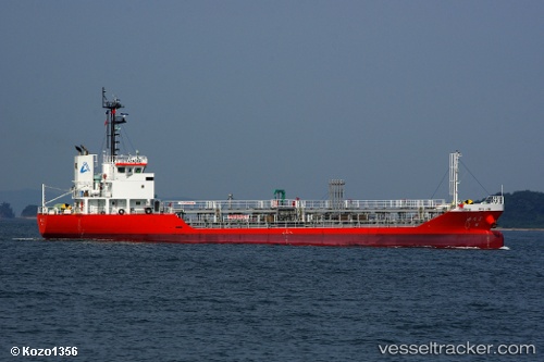
Atago
Current StatusWhere is the vessel?
Atago is currently in Near Kawasaki, based on AIS data received about 1h ago.
Latest AIS update:
Current position: 35.46424° N, 139.72810° E (Near Kawasaki)
Average speed (last 7 days): Loading…
Average speed (last 30 days): Loading…
Vessel profile: Atago is a Chemical Oil Products Tanker with dimensions 10m x 61m.
This page combines live AIS, route history, probable destination signals, nearby traffic, and port activity for practical vessel monitoring.
The current position of vessel Atago is 35.46424 lat / 139.72810 lng. Updated: 2026-05-14 19:55:14 UTCNearest reference points:
- Near Kawasaki
- Near Yokohama
- Near Naka-Ku, Kanagawa
Details:
Live Vessel Atago Analytics (details, animations, etc.)
Recent AIS points (UTC):
2026-05-14 16:55:17 UTC · 35.46417, 139.72816 · SOG 0 kn · COG 52°2026-05-14 17:38:43 UTC · 35.46333, 139.72667 · SOG 0 kn · COG -1°
2026-05-14 19:29:43 UTC · 35.46333, 139.72667 · SOG 0 kn · COG -1°
2026-05-14 19:55:14 UTC · 35.46424, 139.72810 · SOG 0 kn · COG 56°