 vesseltracker.com
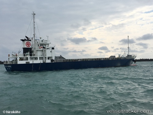
Ryoan Maru No.27
Current StatusWhere is the vessel?
Ryoan Maru No.27 is currently in 11 nm W of Nishitokyo, based on AIS data received less than 1h ago.
Latest AIS update:
Current position: 34.80235° N, 139.32664° E (11 nm W of Nishitokyo)
Average speed (last 7 days): Loading…
Average speed (last 30 days): Loading…
Vessel profile: Ryoan Maru No.27 is a General Cargo Ship with dimensions 12m x 75m.
This page combines live AIS, route history, probable destination signals, nearby traffic, and port activity for practical vessel monitoring.
The current position of vessel Ryoan Maru No.27 is 34.80235 lat / 139.32664 lng. Updated: 2026-05-02 19:33:48 UTCNearest reference points:
- Near Toshima/Tokyo
- Near Nishitokyo
- 15 nm S of Zushi
Details:
Live Vessel Ryoan Maru No.27 Analytics (details, animations, etc.)
Recent AIS points (UTC):
2026-05-02 16:31:07 UTC · 34.55860, 138.70171 · SOG 11.7 kn · COG 83°2026-05-02 18:13:26 UTC · 34.64245, 139.07809 · SOG 11 kn · COG 60°
2026-05-02 19:22:57 UTC · 34.77848, 139.29355 · SOG 12.2 kn · COG 47°
2026-05-02 19:33:48 UTC · 34.80235, 139.32664 · SOG 12.1 kn · COG 51°