 vesseltracker.com
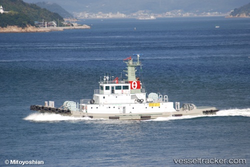
Hojinmaru
Current StatusWhere is the vessel?
Hojinmaru is currently in Near MIZUSHIMA, based on AIS data received about 9h ago.
Latest AIS update:
Current position: 34.47319° N, 133.75821° E (Near MIZUSHIMA)
Average speed (last 7 days): Loading…
Average speed (last 30 days): Loading…
Vessel profile: Hojinmaru is a Tug with dimensions 9m x 39m.
This page combines live AIS, route history, probable destination signals, nearby traffic, and port activity for practical vessel monitoring.
The current position of vessel Hojinmaru is 34.47319 lat / 133.75821 lng. Updated: 2026-04-29 03:11:35 UTCNearest reference points:
- Near MIZUSHIMA
- Near Kurashiki
- Near Sakaide
Details:
Live Vessel Hojinmaru Analytics (details, animations, etc.)
Recent AIS points (UTC):
2026-04-29 03:11:35 UTC · 34.47319, 133.75821 · SOG 0 kn · COG 6°2026-04-29 03:11:35 UTC · 34.47319, 133.75821 · SOG 0 kn · COG 6°
2026-04-29 03:11:35 UTC · 34.47319, 133.75821 · SOG 0 kn · COG 6°
2026-04-29 03:11:35 UTC · 34.47319, 133.75821 · SOG 0 kn · COG 6°