 vesseltracker.com
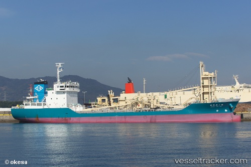
 Tatsumi Maru No.2
Current Status
Where is the vessel?
Tatsumi Maru No.2 is currently in Near Hososima Ko, based on AIS data received less than 1h ago.
Latest AIS update:
Current position: 32.34191° N, 131.80620° E (Near Hososima Ko)
Average speed (last 7 days): Loading…
Average speed (last 30 days): Loading…
Vessel profile: Tatsumi Maru No.2 is a Cement Carrier with dimensions 94m x 16m.
This page combines live AIS, route history, probable destination signals, nearby traffic, and port activity for practical vessel monitoring.
The current position of vessel Tatsumi Maru No.2 is 32.34191 lat / 131.80620 lng. Updated: 2026-04-29 09:45:14 UTCNearest reference points:
- Near Hyuga
- Near MIYAZAKI
- 19 nm SW of Sukumowan
Currently sailing under the flag of Japan ![]()
Details:
Live Vessel Tatsumi Maru No.2 Analytics (details, animations, etc.)
Recent AIS points (UTC):
2026-04-29 01:36:41 UTC · 30.91768, 130.89896 · SOG 14.4 kn · COG 44°2026-04-29 07:25:44 UTC · 31.91850, 131.58554 · SOG 11.3 kn · COG 24°
2026-04-29 07:59:33 UTC · 32.01902, 131.63638 · SOG 11.8 kn · COG 25°
2026-04-29 09:45:14 UTC · 32.34191, 131.80620 · SOG 11.7 kn · COG 26°