 vesseltracker.com
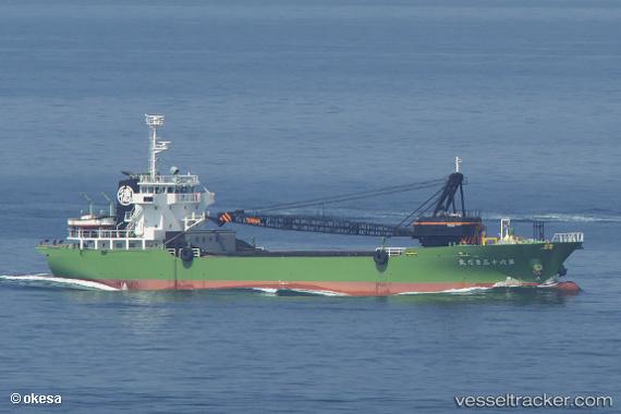
 Sadamaru No.63
Current Status
Where is the vessel?
Sadamaru No.63 is currently in 12 nm W of Nishitokyo, based on AIS data received less than 1h ago.
Latest AIS update:
Current position: 34.79129° N, 139.30289° E (12 nm W of Nishitokyo)
Average speed (last 7 days): Loading…
Average speed (last 30 days): Loading…
Vessel profile: Sadamaru No.63 is a General Cargo Ship with dimensions 77m x 14m.
This page combines live AIS, route history, probable destination signals, nearby traffic, and port activity for practical vessel monitoring.
The current position of vessel Sadamaru No.63 is 34.79129 lat / 139.30289 lng. Updated: 2026-05-15 13:30:12 UTCNearest reference points:
- Near Toshima/Tokyo
- Near Nishitokyo
- 15 nm S of Zushi
Currently sailing under the flag of Japan ![]()
Details:
Live Vessel Sadamaru No.63 Analytics (details, animations, etc.)
Recent AIS points (UTC):
2026-05-15 09:55:21 UTC · 34.57950, 138.48634 · SOG 12.4 kn · COG 92°2026-05-15 10:23:22 UTC · 34.58203, 138.60349 · SOG 12.2 kn · COG 90°
2026-05-15 12:10:03 UTC · 34.62134, 139.01968 · SOG 12.9 kn · COG 66°
2026-05-15 13:30:12 UTC · 34.79129, 139.30289 · SOG 12.8 kn · COG 50°