 vesseltracker.com
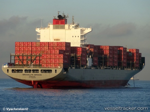
 BROOKLYN BRIDGE
Current Status
Where is the vessel?
BROOKLYN BRIDGE is currently in 66 nm E of Kampung Jawa, based on AIS data received about 1h ago.
Latest AIS update:
Current position: 3.04667° N, 104.63167° E (66 nm E of Kampung Jawa)
Average speed (last 7 days): Loading…
Average speed (last 30 days): Loading…
Vessel profile: BROOKLYN BRIDGE is a Container Ship with dimensions m x m.
This page combines live AIS, route history, probable destination signals, nearby traffic, and port activity for practical vessel monitoring.
The current position of vessel BROOKLYN BRIDGE is 3.04667 lat / 104.63167 lng. Updated: 2026-05-15 21:48:27 UTCNearest reference points:
- 80 nm SW of Terempa
- 64 nm NE of PENGERANG
- 53 nm NE of PENGERANG
Currently sailing under the flag of Japan ![]()
Details:
Live Vessel BROOKLYN BRIDGE Analytics (details, animations, etc.)
Recent AIS points (UTC):
2026-05-15 17:40:37 UTC · 2.16983, 104.66723 · SOG 14.3 kn · COG 32°2026-05-15 19:04:59 UTC · 2.46595, 104.77029 · SOG 13.3 kn · COG 348°
2026-05-15 19:30:26 UTC · 2.55833, 104.75333 · SOG 13 kn · COG -1°
2026-05-15 21:48:27 UTC · 3.04667, 104.63167 · SOG 12 kn · COG -1°