 vesseltracker.com
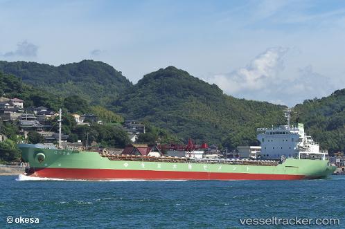
Harima Maru
Current StatusWhere is the vessel?
Harima Maru is currently in Near Hiroshima, based on AIS data received less than 1h ago.
Latest AIS update:
Current position: 34.32003° N, 132.48354° E (Near Hiroshima)
Average speed (last 7 days): Loading…
Average speed (last 30 days): Loading…
Vessel profile: Harima Maru is a Limestone Carrier with dimensions 20m x 151m.
This page combines live AIS, route history, probable destination signals, nearby traffic, and port activity for practical vessel monitoring.
The current position of vessel Harima Maru is 34.32003 lat / 132.48354 lng. Updated: 2026-05-12 19:24:56 UTCNearest reference points:
- Near Hiroshima
- Near Kure
- Near TSUWAJI
Details:
Live Vessel Harima Maru Analytics (details, animations, etc.)
Recent AIS points (UTC):
2026-05-12 15:24:55 UTC · 34.32064, 132.48308 · SOG 0 kn · COG 59°2026-05-12 16:33:56 UTC · 34.32004, 132.48370 · SOG 0 kn · COG 16°
2026-05-12 17:51:58 UTC · 34.31998, 132.48363 · SOG 0 kn · COG 18°
2026-05-12 19:24:56 UTC · 34.32003, 132.48354 · SOG 0 kn · COG 18°