 vesseltracker.com
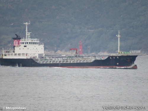
Ryojitsumaru
Current StatusWhere is the vessel?
Ryojitsumaru is currently in 24 nm S of HAMAJIMA, based on AIS data received about 1h ago.
Latest AIS update:
Current position: 33.92791° N, 136.58482° E (24 nm S of HAMAJIMA)
Average speed (last 7 days): Loading…
Average speed (last 30 days): Loading…
Vessel profile: Ryojitsumaru is a Chemical Tanker with dimensions 11m x 72m.
This page combines live AIS, route history, probable destination signals, nearby traffic, and port activity for practical vessel monitoring.
The current position of vessel Ryojitsumaru is 33.92791 lat / 136.58482 lng. Updated: 2026-04-28 10:15:06 UTCNearest reference points:
- 20 nm S of HAMAJIMA
- Near TOBA
- 12 nm E of TOBA
Details:
Live Vessel Ryojitsumaru Analytics (details, animations, etc.)
Recent AIS points (UTC):
2026-04-28 07:33:11 UTC · 34.24925, 137.11485 · SOG 11.9 kn · COG 249°2026-04-28 07:46:29 UTC · 34.23298, 137.06558 · SOG 12 kn · COG 246°
2026-04-28 09:59:27 UTC · 33.96261, 136.63249 · SOG 12.1 kn · COG 230°
2026-04-28 10:15:06 UTC · 33.92791, 136.58482 · SOG 11.9 kn · COG 232°