 vesseltracker.com
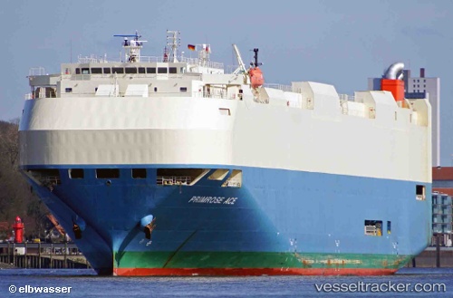
 PRIMROSE ACE
Current Status
Where is the vessel?
PRIMROSE ACE is currently in 136 nm NW of Henties Bay (Hentiesbaai), based on AIS data received less than 1h ago.
Latest AIS update:
Current position: 20.79833° S, 12.31167° E (136 nm NW of Henties Bay (Hentiesbaai))
Average speed (last 7 days): Loading…
Average speed (last 30 days): Loading…
Vessel profile: PRIMROSE ACE is a Vehicles Carrier with dimensions m x m.
This page combines live AIS, route history, probable destination signals, nearby traffic, and port activity for practical vessel monitoring.
The current position of vessel PRIMROSE ACE is -20.79833 lat / 12.31167 lng. Updated: 2026-05-16 14:07:51 UTCNearest reference points:
- 136 nm S of Baía dos Tigres
- 151 nm W of Henties Bay (Hentiesbaai)
- Near WALVIS BAY
Currently sailing under the flag of Japan ![]()
Details:
Live Vessel PRIMROSE ACE Analytics (details, animations, etc.)
Recent AIS points (UTC):
2026-05-16 10:03:44 UTC · -20.21200, 11.67563 · SOG 12.5 kn · COG 136°2026-05-16 12:18:32 UTC · -20.53755, 12.02967 · SOG 12.7 kn · COG 135°
2026-05-16 14:01:33 UTC · -20.78344, 12.29538 · SOG 12.3 kn · COG 137°
2026-05-16 14:07:51 UTC · -20.79833, 12.31167 · SOG 12 kn · COG -1°