 vesseltracker.com
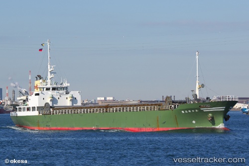
Wakaba Ni Sei
Current StatusWhere is the vessel?
Wakaba Ni Sei is currently in Near Iruma, based on AIS data received about 1h ago.
Latest AIS update:
Current position: 34.57008° N, 138.68491° E (Near Iruma)
Average speed (last 7 days): Loading…
Average speed (last 30 days): Loading…
Vessel profile: Wakaba Ni Sei is a General Cargo Ship with dimensions 12m x 77m.
This page combines live AIS, route history, probable destination signals, nearby traffic, and port activity for practical vessel monitoring.
The current position of vessel Wakaba Ni Sei is 34.57008 lat / 138.68491 lng. Updated: 2026-05-16 10:43:42 UTCNearest reference points:
- Near Iruma
- 10 nm SE of Iruma
- Near OMAEZAKI
Details:
Live Vessel Wakaba Ni Sei Analytics (details, animations, etc.)
Recent AIS points (UTC):
2026-05-16 07:13:02 UTC · 34.54833, 137.90334 · SOG 11 kn · COG -1°2026-05-16 07:41:14 UTC · 34.55062, 138.01163 · SOG 11.3 kn · COG 95°
2026-05-16 09:28:43 UTC · 34.55539, 138.40556 · SOG 10.8 kn · COG 88°
2026-05-16 10:43:42 UTC · 34.57008, 138.68491 · SOG 10.3 kn · COG 89°