 vesseltracker.com
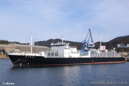
 Nikko
Nikko
Current Status
Where is the vessel?
Nikko is currently in Near KASHIMA, based on AIS data received less than 1h ago.
Latest AIS update:
Current position: 35.89307° N, 140.87445° E (Near KASHIMA)
Average speed (last 7 days): Loading…
Average speed (last 30 days): Loading…
Vessel profile: Nikko is a Ro Ro Cargo Ship with dimensions 94m x 94m.
This page combines live AIS, route history, probable destination signals, nearby traffic, and port activity for practical vessel monitoring.
The current position of vessel Nikko is 35.89307 lat / 140.87445 lng. Updated: 2026-05-14 09:32:22 UTCNearest reference points:
- Near KASHIMA
- 12 nm E of CHOSHI
- Near Mito
Currently sailing under the flag of Japan ![]()
Details:
Live Vessel Nikko Analytics (details, animations, etc.)
Recent AIS points (UTC):
2026-05-14 06:15:57 UTC · 36.49527, 140.62514 · SOG 0 kn · COG 155°2026-05-14 07:38:58 UTC · 36.32728, 140.73265 · SOG 13.7 kn · COG 159°
2026-05-14 07:43:06 UTC · 36.31238, 140.73997 · SOG 13.9 kn · COG 159°
2026-05-14 09:32:22 UTC · 35.89307, 140.87445 · SOG 14.2 kn · COG 157°