 vesseltracker.com
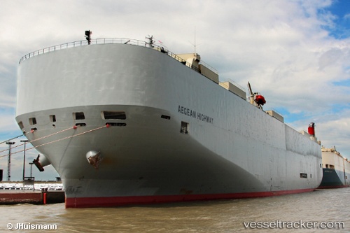
 Aegean Highway
Current Status
Where is the vessel?
Aegean Highway is currently in Open sea (no nearby ports in database), based on AIS data received about 1h ago.
Latest AIS update:
Current position: 25.35118° N, 124.84822° W (Open sea (no nearby ports in database))
Average speed (last 7 days): Loading…
Average speed (last 30 days): Loading…
Vessel profile: Aegean Highway is a Vehicles Carrier with dimensions 199m x 32m.
This page combines live AIS, route history, probable destination signals, nearby traffic, and port activity for practical vessel monitoring.
The current position of vessel Aegean Highway is 25.35118 lat / -124.84822 lng. Updated: 2026-04-28 13:20:43 UTCNearest reference points:
- Open sea (no nearby ports in database)
- Open sea, approx. 554 nm off the nearest listed port
- Open sea, approx. 548 nm off the nearest listed port
Currently sailing under the flag of Japan ![]()
Aegean Highway built in 2008 year
Deadweight:
18867 tDetails:
Live Vessel Aegean Highway Analytics (details, animations, etc.)
Recent AIS points (UTC):
2026-04-28 10:01:48 UTC · 25.07302, -123.91682 · SOG 15.8 kn · COG 287°2026-04-28 11:48:24 UTC · 25.22125, -124.41388 · SOG 16.5 kn · COG 287°
2026-04-28 13:02:48 UTC · 25.32672, -124.76362 · SOG 16.3 kn · COG 286°
2026-04-28 13:20:43 UTC · 25.35118, -124.84822 · SOG 16.1 kn · COG 286°