 vesseltracker.com
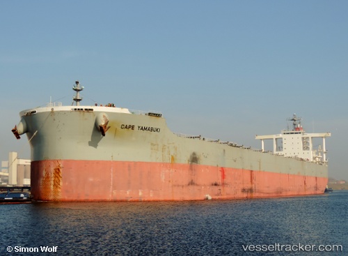
 Cape Yamabuki
Current Status
Where is the vessel?
Cape Yamabuki is currently in 174 nm N of Mutineer, based on AIS data received about 1h ago.
Latest AIS update:
Current position: 16.52181° S, 117.56043° E (174 nm N of Mutineer)
Average speed (last 7 days): Loading…
Average speed (last 30 days): Loading…
Vessel profile: Cape Yamabuki is a Bulk Carrier with dimensions 292m x 45m.
This page combines live AIS, route history, probable destination signals, nearby traffic, and port activity for practical vessel monitoring.
The current position of vessel Cape Yamabuki is -16.52181 lat / 117.56043 lng. Updated: 2026-04-26 06:21:08 UTCNearest reference points:
- 185 nm NE of Mutineer
- 121 nm NE of Mutineer
- 244 nm N of Mutineer
Currently sailing under the flag of Japan ![]()
Cape Yamabuki built in 2010 year
Deadweight:
182534 tDetails:
Live Vessel Cape Yamabuki Analytics (details, animations, etc.)
Recent AIS points (UTC):
2026-04-26 02:03:10 UTC · -15.58833, 117.32167 · SOG 13 kn · COG -1°2026-04-26 04:06:07 UTC · -16.03333, 117.43833 · SOG 13 kn · COG -1°
2026-04-26 04:56:01 UTC · -16.21661, 117.47798 · SOG 13.4 kn · COG 168°
2026-04-26 06:21:08 UTC · -16.52181, 117.56043 · SOG 13 kn · COG 163°