 vesseltracker.com
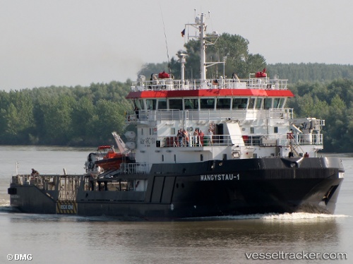
 MANGYSTAU 1
Current Status
Where is the vessel?
MANGYSTAU 1 is currently in Near Hazar, based on AIS data received about 1226d ago.
Latest AIS update:
Current position: 39.41565° N, 53.10058° E (Near Hazar)
Average speed (last 7 days): Loading…
Average speed (last 30 days): Loading…
Vessel profile: MANGYSTAU 1 is a Tug with dimensions 16m x 66m.
This page combines live AIS, route history, probable destination signals, nearby traffic, and port activity for practical vessel monitoring.
The current position of vessel MANGYSTAU 1 is 39.41565 lat / 53.10058 lng. Updated: 2023-01-06 02:24:24 UTCNearest reference points:
- Near Hazar
- Near Krasnovodsk
- 42 nm W of Hazar
Currently sailing under the flag of Kazakhstan ![]()
MANGYSTAU 1 built in 2010 year
Deadweight:
729 tDetails:
Live Vessel MANGYSTAU 1 Analytics (details, animations, etc.)
Recent AIS points (UTC):
2023-01-06 02:24:24 UTC · 39.41565, 53.10058 · SOG 0 kn · COG 331°