 vesseltracker.com
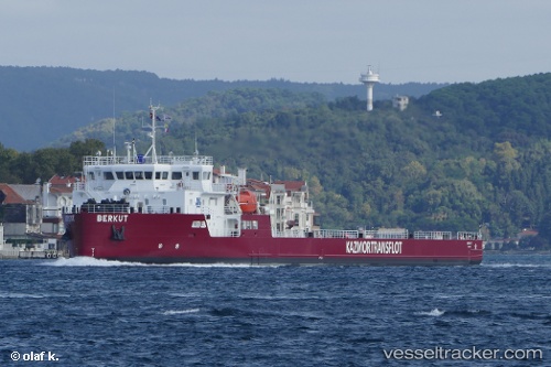
Berkut
Current StatusWhere is the vessel?
Berkut is currently in Near Aktau, based on AIS data received about 1h ago.
Latest AIS update:
Current position: 43.56171° N, 51.21015° E (Near Aktau)
Average speed (last 7 days): Loading…
Average speed (last 30 days): Loading…
Vessel profile: Berkut is a Deck Cargo Ship with dimensions 21m x 113m.
This page combines live AIS, route history, probable destination signals, nearby traffic, and port activity for practical vessel monitoring.
The current position of vessel Berkut is 43.56171 lat / 51.21015 lng. Updated: 2026-05-14 06:12:10 UTCNearest reference points:
- 12 nm S of Aktau
- 24 nm W of Kuryk
- 35 nm W of Kuryk
Details:
Live Vessel Berkut Analytics (details, animations, etc.)
Recent AIS points (UTC):
2026-05-14 02:54:08 UTC · 43.56171, 51.21013 · SOG 0 kn · COG 141°2026-05-14 04:00:09 UTC · 43.56172, 51.21019 · SOG 0 kn · COG 196°
2026-05-14 05:03:10 UTC · 43.56174, 51.21030 · SOG 0 kn · COG 189°
2026-05-14 06:12:10 UTC · 43.56171, 51.21015 · SOG 0 kn · COG 161°