 vesseltracker.com
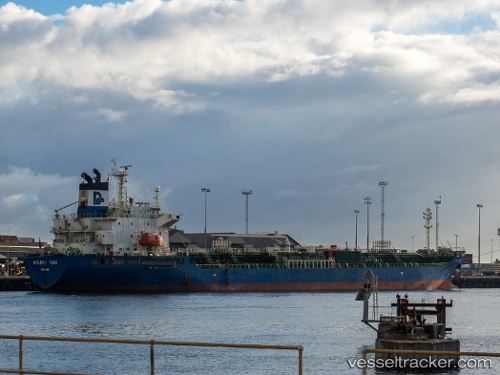
 CNC DREAM
Current Status
Where is the vessel?
CNC DREAM is currently in 42 nm NE of Port Sultan, based on AIS data received about 3h ago.
Latest AIS update:
Current position: 24.19367° N, 59.06738° E (42 nm NE of Port Sultan)
Average speed (last 7 days): Loading…
Average speed (last 30 days): Loading…
Vessel profile: CNC DREAM is a Chemical/Oil Products Tanker with dimensions 144m x 24m.
This page combines live AIS, route history, probable destination signals, nearby traffic, and port activity for practical vessel monitoring.
The current position of vessel CNC DREAM is 24.19367 lat / 59.06738 lng. Updated: 2026-05-02 13:19:56 UTCNearest reference points:
- 58 nm S of JASK
- 59 nm S of Chah Bahar
- 23 nm NE of Qalhat
Currently sailing under the flag of Korea (Republic of) ![]()
CNC DREAM built in 2004 year
Deadweight:
19773 tDetails:
Live Vessel CNC DREAM Analytics (details, animations, etc.)
Recent AIS points (UTC):
2026-05-02 13:16:15 UTC · 24.18838, 59.07873 · SOG 11.3 kn · COG 302°2026-05-02 13:19:56 UTC · 24.19367, 59.06738 · SOG 11.5 kn · COG 300°
2026-05-02 13:19:56 UTC · 24.19367, 59.06738 · SOG 11.5 kn · COG 300°
2026-05-02 13:19:56 UTC · 24.19367, 59.06738 · SOG 11.5 kn · COG 300°