 vesseltracker.com
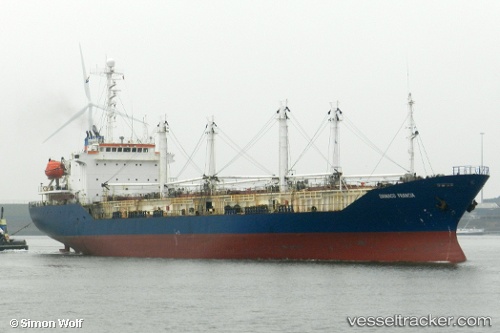
Sein Sky
Current StatusWhere is the vessel?
Sein Sky is currently in Near T S Transport and Logistics, based on AIS data received less than 1h ago.
Latest AIS update:
Current position: 13.65530° N, 100.56455° E (Near T S Transport and Logistics)
Average speed (last 7 days): Loading…
Average speed (last 30 days): Loading…
Vessel profile: Sein Sky is a Refrigerated Cargo Ship with dimensions 22m x 82m.
This page combines live AIS, route history, probable destination signals, nearby traffic, and port activity for practical vessel monitoring.
The current position of vessel Sein Sky is 13.65530 lat / 100.56455 lng. Updated: 2026-05-15 16:59:09 UTCNearest reference points:
- Near T S Transport and Logistics
- Near Nim Port
- Near Bangkok Modern Terminals/Bangkok
Details:
Live Vessel Sein Sky Analytics (details, animations, etc.)
Recent AIS points (UTC):
2026-05-15 13:23:09 UTC · 13.65529, 100.56453 · SOG 0 kn · COG 73°2026-05-15 14:05:09 UTC · 13.65531, 100.56450 · SOG 0 kn · COG 73°
2026-05-15 15:53:09 UTC · 13.65532, 100.56453 · SOG 0 kn · COG 73°
2026-05-15 16:59:09 UTC · 13.65530, 100.56455 · SOG 0 kn · COG 73°