 vesseltracker.com
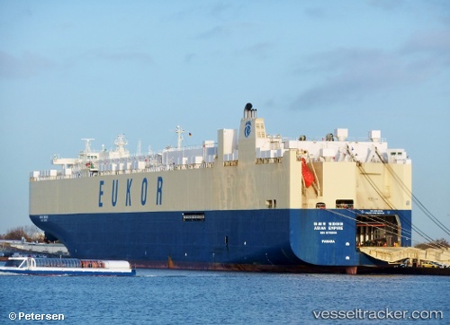
Asian Empire
Current StatusWhere is the vessel?
Asian Empire is currently in 58 nm NE of PENGERANG, based on AIS data received about 1h ago.
Latest AIS update:
Current position: 1.99008° N, 104.87921° E (58 nm NE of PENGERANG)
Average speed (last 7 days): Loading…
Average speed (last 30 days): Loading…
Vessel profile: Asian Empire is a Vehicles Carrier with dimensions 32m x 229m.
This page combines live AIS, route history, probable destination signals, nearby traffic, and port activity for practical vessel monitoring.
The current position of vessel Asian Empire is 1.99008 lat / 104.87921 lng. Updated: 2026-05-15 19:32:46 UTCNearest reference points:
- 55 nm NE of PENGERANG
- 53 nm NE of PENGERANG
- 51 nm NE of PENGERANG
Details:
Live Vessel Asian Empire Analytics (details, animations, etc.)
Recent AIS points (UTC):
2026-05-15 16:55:34 UTC · 2.54833, 104.98167 · SOG 16 kn · COG -1°2026-05-15 17:40:41 UTC · 2.34817, 104.91814 · SOG 17 kn · COG 191°
2026-05-15 19:05:14 UTC · 2.06386, 104.89757 · SOG 9.9 kn · COG 197°
2026-05-15 19:32:46 UTC · 1.99008, 104.87921 · SOG 10.2 kn · COG 196°