 vesseltracker.com
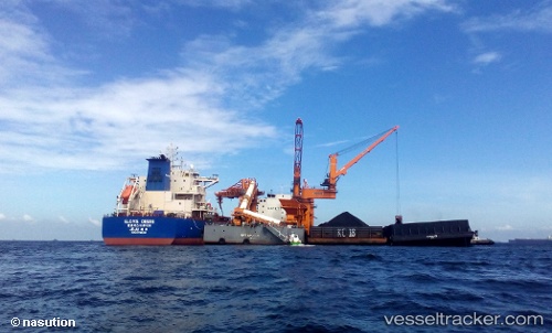
Glovis Desire
Current StatusWhere is the vessel?
Glovis Desire is currently in Near Thetis Island, based on AIS data received about 1h ago.
Latest AIS update:
Current position: 48.94223° N, 123.71506° W (Near Thetis Island)
Average speed (last 7 days): Loading…
Average speed (last 30 days): Loading…
Vessel profile: Glovis Desire is a Bulk Carrier with dimensions 32m x 229m.
This page combines live AIS, route history, probable destination signals, nearby traffic, and port activity for practical vessel monitoring.
The current position of vessel Glovis Desire is 48.94223 lat / -123.71506 lng. Updated: 2026-05-01 10:20:56 UTCNearest reference points:
- Near Cassidy
- Near Harmac
- Near Nanaimo
Details:
Live Vessel Glovis Desire Analytics (details, animations, etc.)
Recent AIS points (UTC):
2026-05-01 07:29:56 UTC · 48.94188, -123.71529 · SOG 0.1 kn · COG 297°2026-05-01 07:39:00 UTC · 48.94190, -123.71512 · SOG 0.1 kn · COG 293°
2026-05-01 09:41:59 UTC · 48.94240, -123.71502 · SOG 0.1 kn · COG 280°
2026-05-01 10:20:56 UTC · 48.94223, -123.71506 · SOG 0 kn · COG 284°