 vesseltracker.com
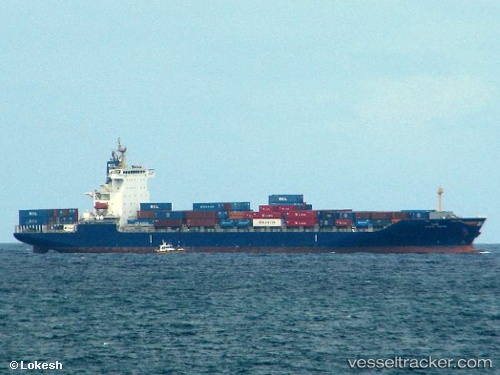
 HMM MANILA
Current Status
Where is the vessel?
HMM MANILA is currently in 33 nm N of Sumenep, based on AIS data received about 2d ago.
Latest AIS update:
Current position: 6.50510° S, 113.96575° E (33 nm N of Sumenep)
Average speed (last 7 days): Loading…
Average speed (last 30 days): Loading…
Vessel profile: HMM MANILA is a Container Ship with dimensions m x m.
This page combines live AIS, route history, probable destination signals, nearby traffic, and port activity for practical vessel monitoring.
The current position of vessel HMM MANILA is -6.50510 lat / 113.96575 lng. Updated: 2026-05-12 20:53:33 UTCNearest reference points:
- 30 nm NW of Sumenep
- 27 nm NE of Camar Marine Terminal
- 76 nm N of Sumenep
Currently sailing under the flag of South Korea ![]()
Details:
Live Vessel HMM MANILA Analytics (details, animations, etc.)
Recent AIS points (UTC):
2026-05-12 20:53:33 UTC · -6.50510, 113.96575 · SOG 16.4 kn · COG 74°2026-05-12 20:53:33 UTC · -6.50510, 113.96575 · SOG 16.4 kn · COG 74°
2026-05-12 20:53:33 UTC · -6.50510, 113.96575 · SOG 16.4 kn · COG 74°
2026-05-12 20:53:33 UTC · -6.50510, 113.96575 · SOG 16.4 kn · COG 74°