 vesseltracker.com
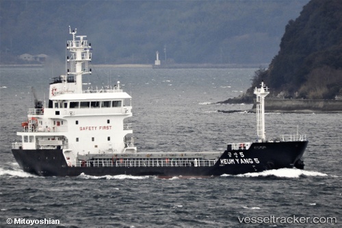
Keum Yang 5
Current StatusWhere is the vessel?
Keum Yang 5 is currently in Near KADA, based on AIS data received about 2h ago.
Latest AIS update:
Current position: 34.36571° N, 135.13422° E (Near KADA)
Average speed (last 7 days): Loading…
Average speed (last 30 days): Loading…
Vessel profile: Keum Yang 5 is a General Cargo Ship with dimensions 14m x 80m.
This page combines live AIS, route history, probable destination signals, nearby traffic, and port activity for practical vessel monitoring.
The current position of vessel Keum Yang 5 is 34.36571 lat / 135.13422 lng. Updated: 2026-04-30 19:30:39 UTCNearest reference points:
- Near KADA
- Near Awaji
- Near AKASHI
Details:
Live Vessel Keum Yang 5 Analytics (details, animations, etc.)
Recent AIS points (UTC):
2026-04-30 16:30:00 UTC · 34.36589, 135.13310 · SOG 0 kn · COG 45°2026-04-30 17:23:40 UTC · 34.36588, 135.13315 · SOG 0 kn · COG 43°
2026-04-30 19:13:11 UTC · 34.36569, 135.13399 · SOG 0.1 kn · COG 346°
2026-04-30 19:30:39 UTC · 34.36571, 135.13422 · SOG 0 kn · COG 323°