 vesseltracker.com
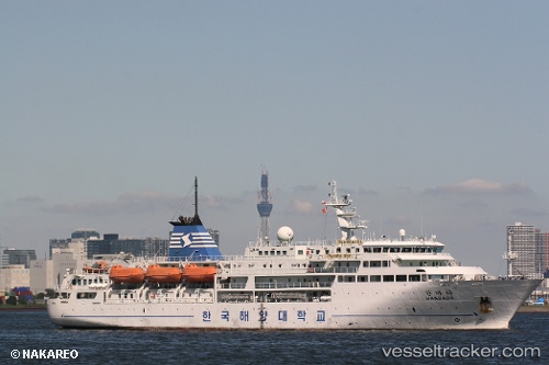
 Hanbada
Current Status
Where is the vessel?
Hanbada is currently in 95 nm NW of Koniya, based on AIS data received about 15h ago.
Latest AIS update:
Current position: 29.50965° N, 128.41682° E (95 nm NW of Koniya)
Average speed (last 7 days): Loading…
Average speed (last 30 days): Loading…
Vessel profile: Hanbada is a Training Ship with dimensions 100m x 30m.
This page combines live AIS, route history, probable destination signals, nearby traffic, and port activity for practical vessel monitoring.
The current position of vessel Hanbada is 29.50965 lat / 128.41682 lng. Updated: 2026-05-14 09:22:01 UTCNearest reference points:
- 71 nm SW of Taniyama
- 18 nm W of Koniya
- 163 nm S of Seogwipo
Currently sailing under the flag of Korea ![]()
Hanbada built in 2005 year
Deadweight:
2636 tDetails:
Live Vessel Hanbada Analytics (details, animations, etc.)
Recent AIS points (UTC):
2026-05-14 09:22:01 UTC · 29.50965, 128.41682 · SOG 13.8 kn · COG 229°2026-05-14 09:22:01 UTC · 29.50965, 128.41682 · SOG 13.8 kn · COG 229°
2026-05-14 09:22:01 UTC · 29.50965, 128.41682 · SOG 13.8 kn · COG 229°
2026-05-14 09:22:01 UTC · 29.50965, 128.41682 · SOG 13.8 kn · COG 229°