 vesseltracker.com
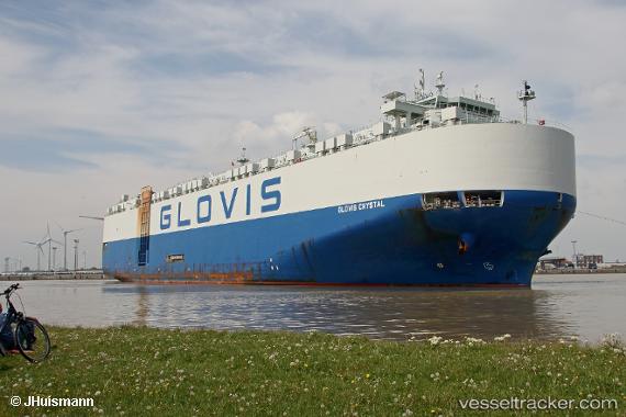
 GLOVIS CRYSTAL
Current Status
Where is the vessel?
GLOVIS CRYSTAL is currently in Near San Antonio, based on AIS data received less than 1h ago.
Latest AIS update:
Current position: 33.58689° S, 71.61887° W (Near San Antonio)
Average speed (last 7 days): Loading…
Average speed (last 30 days): Loading…
Vessel profile: GLOVIS CRYSTAL is a Cargo with dimensions m x m.
This page combines live AIS, route history, probable destination signals, nearby traffic, and port activity for practical vessel monitoring.
The current position of vessel GLOVIS CRYSTAL is -33.58689 lat / -71.61887 lng. Updated: 2026-05-15 09:48:52 UTCNearest reference points:
- Near Valparaiso
- 28 nm W of Pichilemu
- 100 nm W of Curauma
Currently sailing under the flag of South Korea ![]()
Details:
Live Vessel GLOVIS CRYSTAL Analytics (details, animations, etc.)
Recent AIS points (UTC):
2026-05-15 05:45:52 UTC · -33.58687, -71.61886 · SOG 0 kn · COG 319°2026-05-15 07:18:52 UTC · -33.58687, -71.61886 · SOG 0 kn · COG 319°
2026-05-15 08:03:52 UTC · -33.58686, -71.61887 · SOG 0 kn · COG 319°
2026-05-15 09:48:52 UTC · -33.58689, -71.61887 · SOG 0 kn · COG 319°