 vesseltracker.com
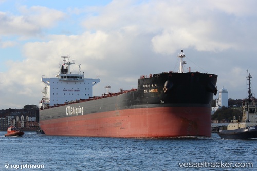
Ck Angie
Current StatusWhere is the vessel?
Ck Angie is currently in 69 nm SE of Saint-Philippe, based on AIS data received less than 1h ago.
Latest AIS update:
Current position: 22.08871° S, 56.73769° E (69 nm SE of Saint-Philippe)
Average speed (last 7 days): Loading…
Average speed (last 30 days): Loading…
Vessel profile: Ck Angie is a Bulk Carrier with dimensions 32m x 229m.
This page combines live AIS, route history, probable destination signals, nearby traffic, and port activity for practical vessel monitoring.
The current position of vessel Ck Angie is -22.08871 lat / 56.73769 lng. Updated: 2026-05-14 21:29:09 UTCNearest reference points:
- 61 nm NW of Al Azaiba
- 129 nm W of Al Azaiba
- Near Port Louis
Details:
Live Vessel Ck Angie Analytics (details, animations, etc.)
Recent AIS points (UTC):
2026-05-14 17:55:29 UTC · -22.41696, 56.17777 · SOG 9.8 kn · COG 59°2026-05-14 19:30:29 UTC · -22.27127, 56.42708 · SOG 10.4 kn · COG 56°
2026-05-14 20:14:18 UTC · -22.20371, 56.54266 · SOG 10.5 kn · COG 57°
2026-05-14 21:29:09 UTC · -22.08871, 56.73769 · SOG 10.2 kn · COG 56°