 vesseltracker.com
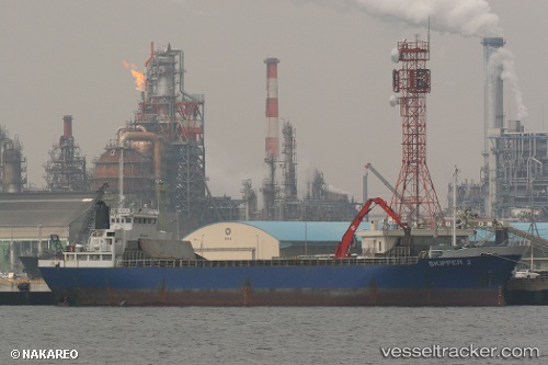
Quan Fu 88
Current StatusWhere is the vessel?
Quan Fu 88 is currently in 41 nm E of JINHAI HEAVY INDUSTR, based on AIS data received less than 1h ago.
Latest AIS update:
Current position: 30.13125° N, 123.01995° E (41 nm E of JINHAI HEAVY INDUSTR)
Average speed (last 7 days): Loading…
Average speed (last 30 days): Loading…
Vessel profile: Quan Fu 88 is a General Cargo Ship with dimensions 13m x 79m.
This page combines live AIS, route history, probable destination signals, nearby traffic, and port activity for practical vessel monitoring.
The current position of vessel Quan Fu 88 is 30.13125 lat / 123.01995 lng. Updated: 2026-05-13 21:21:39 UTCNearest reference points:
- 44 nm E of JINHAI HEAVY INDUSTR
- 40 nm E of JINHAI HEAVY INDUSTR
- 45 nm E of JINHAI HEAVY INDUSTR
Details:
Live Vessel Quan Fu 88 Analytics (details, animations, etc.)
Recent AIS points (UTC):
2026-05-13 17:38:30 UTC · 30.55576, 123.20491 · SOG 7.4 kn · COG 200°2026-05-13 19:23:31 UTC · 30.34845, 123.11534 · SOG 7 kn · COG 196°
2026-05-13 19:56:50 UTC · 30.28167, 123.08667 · SOG 7 kn · COG -1°
2026-05-13 21:21:39 UTC · 30.13125, 123.01995 · SOG 6.4 kn · COG 194°