 vesseltracker.com
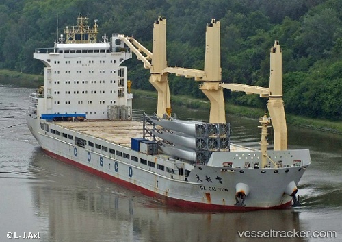
Vessel Da Cai Yun IMO: 9451367, MMSI: 477638800 Multi Purpose Carrier
UTC, 24.80499, 54.66040, course: 139, speed: 0
UTC, 24.80494, 54.66039, course: 139, speed: 0
2026-02-27 00:20:50 UTC, 24.80333, 54.66000, course: -1, speed: 0
Live AIS position:
UTC. Near KHALIFA),
updated 2026-02-27 00:20:50 UTC.
Find the position of the vessel Da Cai Yun on the map. The latter are known coordinates and path.
marine traffic ship tracker show on live map
The current position of vessel Da Cai Yun is 24.80333 lat / 54.66000 lng. Updated: 2026-02-27 00:20:50 UTCDetails:
Last coordinates of the vessel:
UTC, 24.80496, 54.66039, course: 139, speed: 0UTC, 24.80499, 54.66040, course: 139, speed: 0
UTC, 24.80494, 54.66039, course: 139, speed: 0
2026-02-27 00:20:50 UTC, 24.80333, 54.66000, course: -1, speed: 0