 vesseltracker.com
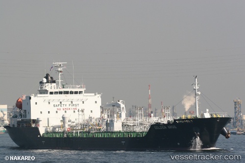
 EASTERN IRIS
Current Status
Where is the vessel?
EASTERN IRIS is currently in Near JURONG ISLAND, based on AIS data received about 1219d ago.
Latest AIS update:
Current position: 1.19282° N, 103.69877° E (Near JURONG ISLAND)
Average speed (last 7 days): Loading…
Average speed (last 30 days): Loading…
Vessel profile: EASTERN IRIS is a Chemical/Oil Products Tanker with dimensions 119m x 20m.
This page combines live AIS, route history, probable destination signals, nearby traffic, and port activity for practical vessel monitoring.
The current position of vessel EASTERN IRIS is 1.19282 lat / 103.69877 lng. Updated: 2023-01-10 05:46:16 UTCNearest reference points:
- Near BUKOM ISLAND
- Near JURONG ISLAND
- Near Pulau Ayer Chawan
Currently sailing under the flag of Hong Kong, China ![]()
EASTERN IRIS built in 2010 year
Deadweight:
12163 tDetails:
Live Vessel EASTERN IRIS Analytics (details, animations, etc.)
Recent AIS points (UTC):
2023-01-10 05:46:16 UTC · 1.19282, 103.69877 · SOG 0 kn · COG 249°