 vesseltracker.com
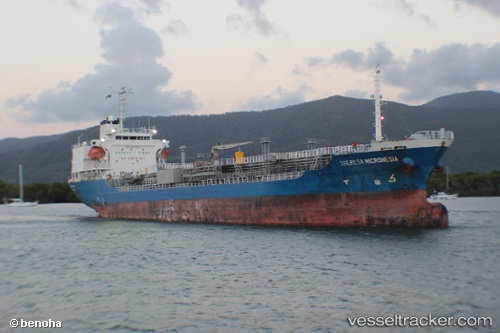
Theresa Micronesia
Current StatusWhere is the vessel?
Theresa Micronesia is currently in Near Coode Island, based on AIS data received less than 1h ago.
Latest AIS update:
Current position: 37.81722° S, 144.90627° E (Near Coode Island)
Average speed (last 7 days): Loading…
Average speed (last 30 days): Loading…
Vessel profile: Theresa Micronesia is a Chemical Oil Products Tanker with dimensions 18m x 120m.
This page combines live AIS, route history, probable destination signals, nearby traffic, and port activity for practical vessel monitoring.
The current position of vessel Theresa Micronesia is -37.81722 lat / 144.90627 lng. Updated: 2026-04-27 16:03:49 UTCNearest reference points:
- Near Spotswood
- Near Drysdale
- Near QUEENSCLIFF
Details:
Live Vessel Theresa Micronesia Analytics (details, animations, etc.)
Recent AIS points (UTC):
2026-04-27 12:09:51 UTC · -37.81723, 144.90630 · SOG 0 kn · COG 170°2026-04-27 14:24:48 UTC · -37.81720, 144.90623 · SOG 0 kn · COG 171°
2026-04-27 16:03:49 UTC · -37.81722, 144.90627 · SOG 0 kn · COG 170°
2026-04-27 16:03:49 UTC · -37.81722, 144.90627 · SOG 0 kn · COG 170°