 vesseltracker.com
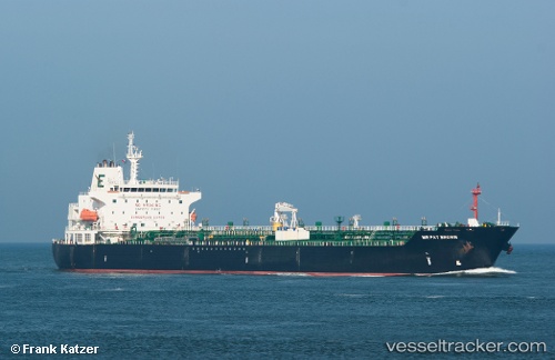
 KANDY
KANDY
Current Status
Where is the vessel?
KANDY is currently in 91 nm NW of Nosy-Be, based on AIS data received about 1h ago.
Latest AIS update:
Current position: 11.95772° S, 47.61475° E (91 nm NW of Nosy-Be)
Average speed (last 7 days): Loading…
Average speed (last 30 days): Loading…
Vessel profile: KANDY is a Oil/Chemical Tanker with dimensions m x m.
This page combines live AIS, route history, probable destination signals, nearby traffic, and port activity for practical vessel monitoring.
The current position of vessel KANDY is -11.95772 lat / 47.61475 lng. Updated: 2026-05-15 11:19:05 UTCNearest reference points:
- 14 nm SW of Nosy-Be
- 103 nm E of Nosy-Be
Currently sailing under the flag of Hong Kong ![]()
Details:
Live Vessel KANDY Analytics (details, animations, etc.)
Recent AIS points (UTC):
2026-05-15 08:27:17 UTC · -11.42188, 48.01902 · SOG 14.5 kn · COG 203°2026-05-15 10:00:51 UTC · -11.73220, 47.80065 · SOG 14.2 kn · COG 215°
2026-05-15 10:15:09 UTC · -11.77662, 47.76607 · SOG 14 kn · COG 215°
2026-05-15 11:19:05 UTC · -11.95772, 47.61475 · SOG 12.5 kn · COG 221°