 vesseltracker.com
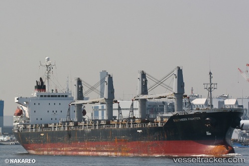
 BLUE BEAD
Current Status
Where is the vessel?
BLUE BEAD is currently in Near BAKIRKOY, based on AIS data received about 420d ago.
Latest AIS update:
Current position: 40.94668° N, 28.89275° E (Near BAKIRKOY)
Average speed (last 7 days): Loading…
Average speed (last 30 days): Loading…
Vessel profile: BLUE BEAD is a General Cargo Ship with dimensions 170m x 27m.
This page combines live AIS, route history, probable destination signals, nearby traffic, and port activity for practical vessel monitoring.
The current position of vessel BLUE BEAD is 40.94668 lat / 28.89275 lng. Updated: 2025-03-20 12:02:32 UTCNearest reference points:
- Near BAKIRKOY
- Near ZEYTINBURNU
- Near Davutpasa
Currently sailing under the flag of Palau (Republic of) ![]()
BLUE BEAD built in 1998 year
Deadweight:
29478 tDetails:
Live Vessel BLUE BEAD Analytics (details, animations, etc.)
Recent AIS points (UTC):
2025-03-20 12:02:32 UTC · 40.94668, 28.89275 · SOG 0 kn · COG 43°