 vesseltracker.com
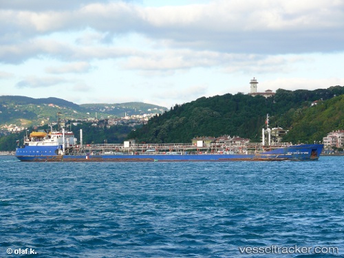
 NAVIGER 2
Current Status
Where is the vessel?
NAVIGER 2 is currently in 122 nm SW of Ghardaïa, based on AIS data received about 686d ago.
Latest AIS update:
Current position: 31.20475° N, 1.80240° E (122 nm SW of Ghardaïa)
Average speed (last 7 days): Loading…
Average speed (last 30 days): Loading…
Vessel profile: NAVIGER 2 is a Oil Products Tanker with dimensions 17m x 132m.
This page combines live AIS, route history, probable destination signals, nearby traffic, and port activity for practical vessel monitoring.
The current position of vessel NAVIGER 2 is 31.20475 lat / 1.80240 lng. Updated: 2024-06-26 07:07:11 UTCCurrently sailing under the flag of Palau (Republic of) ![]()
NAVIGER 2 built in 1976 year
Deadweight:
6564 tDetails:
Live Vessel NAVIGER 2 Analytics (details, animations, etc.)
Recent AIS points (UTC):
2024-06-26 07:07:11 UTC · 31.20475, 1.80240 · SOG 0.5 kn · COG 246°