 vesseltracker.com
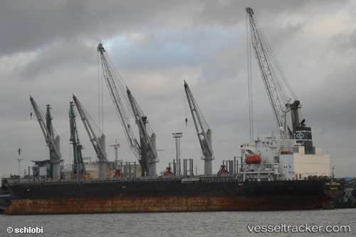
 MARIE
MARIE
Current Status
Where is the vessel?
MARIE is currently in Near Trincomalee, based on AIS data received less than 1h ago.
Latest AIS update:
Current position: 8.60667° N, 81.24667° E (Near Trincomalee)
Average speed (last 7 days): Loading…
Average speed (last 30 days): Loading…
Vessel profile: MARIE is a Bulk Carrier with dimensions m x m.
This page combines live AIS, route history, probable destination signals, nearby traffic, and port activity for practical vessel monitoring.
The current position of vessel MARIE is 8.60667 lat / 81.24667 lng. Updated: 2026-04-27 23:48:46 UTCNearest reference points:
- 67 nm E of Oluvil
- 42 nm E of Konwelana
- 40 nm E of Konwelana
Currently sailing under the flag of Palau ![]()
Details:
Live Vessel MARIE Analytics (details, animations, etc.)
Recent AIS points (UTC):
2026-04-27 19:39:04 UTC · 8.60817, 81.24678 · SOG 0.1 kn · COG 175°2026-04-27 21:24:45 UTC · 8.60667, 81.24667 · SOG 0 kn · COG -1°
2026-04-27 22:09:43 UTC · 8.60667, 81.24667 · SOG 0 kn · COG -1°
2026-04-27 23:48:46 UTC · 8.60667, 81.24667 · SOG 0 kn · COG -1°