 vesseltracker.com
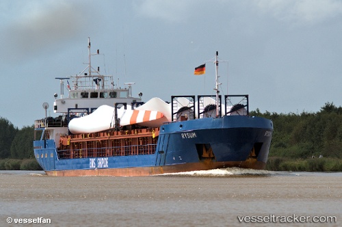
 SEMSA
SEMSA
Current Status
Where is the vessel?
SEMSA is currently in 19 nm N of Port Said, based on AIS data received about 1h ago.
Latest AIS update:
Current position: 31.58884° N, 32.33190° E (19 nm N of Port Said)
Average speed (last 7 days): Loading…
Average speed (last 30 days): Loading…
Vessel profile: SEMSA is a General Cargo with dimensions m x m.
This page combines live AIS, route history, probable destination signals, nearby traffic, and port activity for practical vessel monitoring.
The current position of vessel SEMSA is 31.58884 lat / 32.33190 lng. Updated: 2026-04-28 05:11:06 UTCNearest reference points:
- 16 nm N of Port Said
- 15 nm N of Port Said
- 14 nm N of Port Said
Currently sailing under the flag of Palau ![]()
Details:
Live Vessel SEMSA Analytics (details, animations, etc.)
Recent AIS points (UTC):
2026-04-28 01:30:04 UTC · 31.58870, 32.33177 · SOG 0.1 kn · COG 299°2026-04-28 04:00:12 UTC · 31.58867, 32.33180 · SOG 0.1 kn · COG 308°
2026-04-28 04:32:53 UTC · 31.58876, 32.33188 · SOG 0.2 kn · COG 300°
2026-04-28 05:11:06 UTC · 31.58884, 32.33190 · SOG 0 kn · COG 289°