 vesseltracker.com
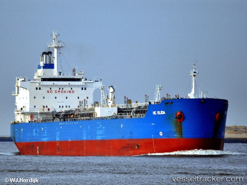
 KURDOS
Current Status
Where is the vessel?
KURDOS is currently in 16 nm NW of Sharjah, based on AIS data received about 112d ago.
Latest AIS update:
Current position: 25.57189° N, 55.13142° E (16 nm NW of Sharjah)
Average speed (last 7 days): Loading…
Average speed (last 30 days): Loading…
Vessel profile: KURDOS is a Oil/Chemical Tanker with dimensions m x m.
This page combines live AIS, route history, probable destination signals, nearby traffic, and port activity for practical vessel monitoring.
The current position of vessel KURDOS is 25.57189 lat / 55.13142 lng. Updated: 2026-01-21 09:01:26 UTCNearest reference points:
- 17 nm NW of Free Port
- Near Sharjah
- Near Free Port
Currently sailing under the flag of Palau ![]()
Details:
Live Vessel KURDOS Analytics (details, animations, etc.)
Recent AIS points (UTC):
2026-01-21 09:01:26 UTC · 25.57189, 55.13142 · SOG 0.7 kn · COG 296°