 vesseltracker.com
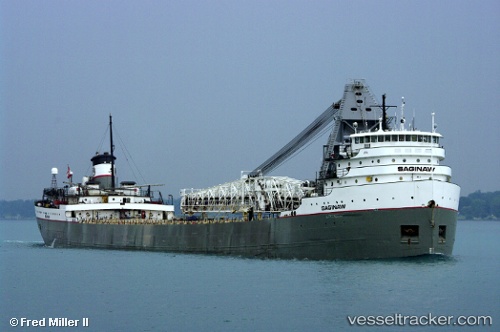
Saginaw
Current StatusWhere is the vessel?
Saginaw is currently in Near Fort William, based on AIS data received about 110d ago.
Latest AIS update:
Current position: 48.35508° N, 89.22029° W (Near Fort William)
Average speed (last 7 days): Loading…
Average speed (last 30 days): Loading…
Vessel profile: Saginaw is a Self Discharging Bulk Carrier with dimensions 22m x 193m.
This page combines live AIS, route history, probable destination signals, nearby traffic, and port activity for practical vessel monitoring.
The current position of vessel Saginaw is 48.35508 lat / -89.22029 lng. Updated: 2026-01-09 00:41:51 UTCNearest reference points:
- Near La Pointe
Details:
Live Vessel Saginaw Analytics (details, animations, etc.)
Recent AIS points (UTC):
2026-01-09 00:41:51 UTC · 48.35508, -89.22029 · SOG 1.7 kn · COG 118°