 vesseltracker.com
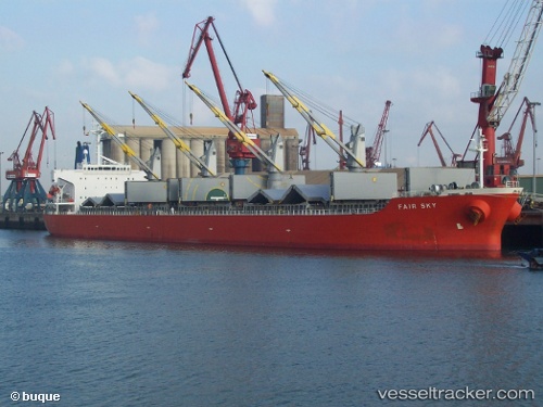
Mv Naziha
Current StatusWhere is the vessel?
Mv Naziha is currently in Near Plaju, Sumatra, based on AIS data received about 1h ago.
Latest AIS update:
Current position: 2.98106° S, 104.77656° E (Near Plaju, Sumatra)
Average speed (last 7 days): Loading…
Average speed (last 30 days): Loading…
Vessel profile: Mv Naziha is a Bulk Carrier with dimensions 40m x 186m.
This page combines live AIS, route history, probable destination signals, nearby traffic, and port activity for practical vessel monitoring.
The current position of vessel Mv Naziha is -2.98106 lat / 104.77656 lng. Updated: 2026-05-01 14:18:25 UTCNearest reference points:
- Near Kertapati
- 36 nm SW of Exspan
- 38 nm SW of PANGKAL BALAM
Details:
Live Vessel Mv Naziha Analytics (details, animations, etc.)
Recent AIS points (UTC):
2026-05-01 10:10:56 UTC · -2.98955, 104.82462 · SOG 7.3 kn · COG -1°2026-05-01 10:13:56 UTC · -2.98919, 104.83071 · SOG 7.3 kn · COG -1°
2026-05-01 13:15:26 UTC · -2.98105, 104.77656 · SOG 0 kn · COG -1°
2026-05-01 14:18:25 UTC · -2.98106, 104.77656 · SOG 0 kn · COG -1°