 vesseltracker.com
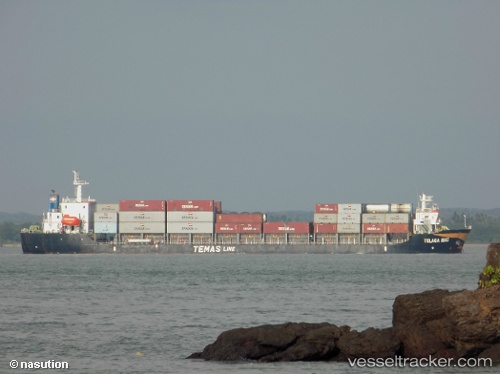
Mv.telaga Mas
Current StatusWhere is the vessel?
Mv.telaga Mas is currently in 39 nm NE of Pelabuhan Badas, based on AIS data received less than 1h ago.
Latest AIS update:
Current position: 7.88833° S, 117.68833° E (39 nm NE of Pelabuhan Badas)
Average speed (last 7 days): Loading…
Average speed (last 30 days): Loading…
Vessel profile: Mv.telaga Mas is a Container Ship with dimensions 22m x 120m.
This page combines live AIS, route history, probable destination signals, nearby traffic, and port activity for practical vessel monitoring.
The current position of vessel Mv.telaga Mas is -7.88833 lat / 117.68833 lng. Updated: 2026-05-15 04:16:05 UTCNearest reference points:
- 30 nm N of BIMA
- 37 nm E of Pagerungan
- Near LEMBAR
Details:
Live Vessel Mv.telaga Mas Analytics (details, animations, etc.)
Recent AIS points (UTC):
2026-05-14 21:36:13 UTC · -8.00167, 118.32500 · SOG 5 kn · COG -1°2026-05-14 22:18:01 UTC · -8.00167, 118.25500 · SOG 6 kn · COG -1°
2026-05-14 23:06:24 UTC · -8.00096, 118.16990 · SOG 6.5 kn · COG -1°
2026-05-15 04:16:05 UTC · -7.88833, 117.68833 · SOG 6 kn · COG -1°