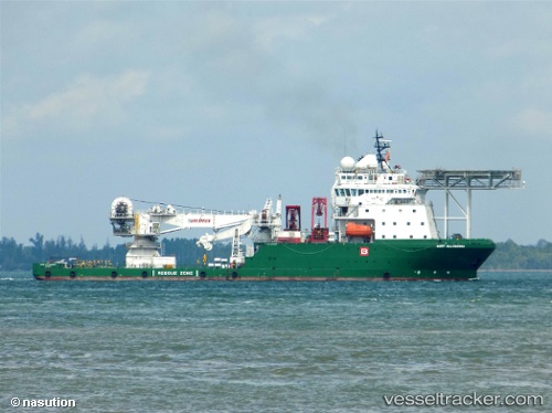
.
Vessel photo of Surf Allamanda (IMO 9639866) vesseltracker.com

Surf Allamanda

Vessel type: Offshore Support Vessel | IMO: 9639866 | MMSI: MMSI: 525021439
Call sign: YBKL2 | Dimensions: 21 m x 100 m
Current Status

Where is the vessel?

Surf Allamanda is currently in 104 nm NE of Karumba, based on AIS data received about 179d ago.

Latest AIS update:

Current position: 15.89931° S, 141.55779° E (104 nm NE of Karumba)

Average speed (last 7 days): Loading…

Average speed (last 30 days): Loading…

Vessel profile: Surf Allamanda is a Offshore Support Vessel with dimensions 21m x 100m.

This page combines live AIS, route history, probable destination signals, nearby traffic, and port activity for practical vessel monitoring.

The current position of vessel Surf Allamanda is -15.89931 lat / 141.55779 lng. Updated: 2025-10-31 08:36:50 UTC
Details:

Live Vessel Surf Allamanda Analytics (details, animations, etc.)


Recent AIS points (UTC):
2025-10-31 08:36:50 UTC · -15.89931, 141.55779 · SOG 101.5 kn · COG -1°

Track of the vessel in the last 60 days


UTC: --
Start: -- Track timeline (UTC) End: --
Encountered: --


Link to the map:


Find another ship

Surf_Allamanda (525021439) last ports (portcalls and passsages)

Sambu | 2022-10-24 01:41:20
Sambu | 2022-10-19 22:51:32
Balikpapan | 2022-10-12 11:01:21
Balikpapan | 2022-10-04 23:04:53
Balikpapan | 2022-09-04 23:01:58
Balikpapan | 2022-07-18 14:07:00
Balikpapan | 2022-06-30 13:31:33
Balikpapan | 2022-06-21 13:10:35
Balikpapan | 2022-06-16 13:02:43
Sambu | 2022-06-07 04:12:44
Sambu | 2022-05-30 01:51:46
Sambu | 2022-05-20 01:12:20
Sambu | 2022-05-14 14:08:07
Sambu | 2022-05-10 13:39:43
Sambu | 2022-05-06 13:09:12
Sambu | 2022-05-02 12:19:31