 vesseltracker.com
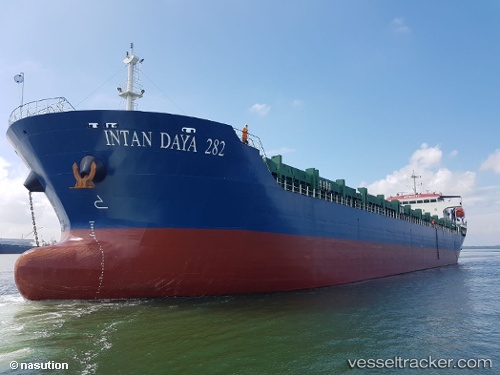
Intan Daya 282
Current StatusWhere is the vessel?
Intan Daya 282 is currently in 40 nm S of Panakukang, based on AIS data received less than 1h ago.
Latest AIS update:
Current position: 5.80588° S, 119.62602° E (40 nm S of Panakukang)
Average speed (last 7 days): Loading…
Average speed (last 30 days): Loading…
Vessel profile: Intan Daya 282 is a General Cargo Ship with dimensions 12m x 117m.
This page combines live AIS, route history, probable destination signals, nearby traffic, and port activity for practical vessel monitoring.
The current position of vessel Intan Daya 282 is -5.80588 lat / 119.62602 lng. Updated: 2026-05-14 07:39:14 UTCNearest reference points:
- Near Panakukang
- Near Makassar
- 12 nm W of Panakukang
Details:
Live Vessel Intan Daya 282 Analytics (details, animations, etc.)
Recent AIS points (UTC):
2026-05-14 04:01:54 UTC · -5.73811, 120.15237 · SOG 9.4 kn · COG 266°2026-05-14 05:04:34 UTC · -5.76187, 119.99893 · SOG 8.2 kn · COG 266°
2026-05-14 07:39:14 UTC · -5.80588, 119.62602 · SOG 9.1 kn · COG 267°
2026-05-14 07:39:14 UTC · -5.80588, 119.62602 · SOG 9.1 kn · COG 267°