 vesseltracker.com
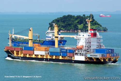
 Selatan Damai
Current Status
Where is the vessel?
Selatan Damai is currently in 35 nm E of Samui Apt, based on AIS data received about 15h ago.
Latest AIS update:
Current position: 9.56278° N, 100.65691° E (35 nm E of Samui Apt)
Average speed (last 7 days): Loading…
Average speed (last 30 days): Loading…
Vessel profile: Selatan Damai is a Container Ship with dimensions 116m x 116m.
This page combines live AIS, route history, probable destination signals, nearby traffic, and port activity for practical vessel monitoring.
The current position of vessel Selatan Damai is 9.56278 lat / 100.65691 lng. Updated: 2026-04-27 04:40:57 UTCNearest reference points:
- Near Samui Apt
- Near Ko Samui
- Near Nakhon Si Thammarat
Currently sailing under the flag of Indonesia ![]()
Selatan Damai built in 2007 year
Deadweight:
8150 tDetails:
Live Vessel Selatan Damai Analytics (details, animations, etc.)
Recent AIS points (UTC):
2026-04-27 04:40:57 UTC · 9.56278, 100.65691 · SOG 11.1 kn · COG 166°2026-04-27 04:40:57 UTC · 9.56278, 100.65691 · SOG 11.1 kn · COG 166°
2026-04-27 04:40:57 UTC · 9.56278, 100.65691 · SOG 11.1 kn · COG 166°
2026-04-27 04:40:57 UTC · 9.56278, 100.65691 · SOG 11.1 kn · COG 166°