 vesseltracker.com
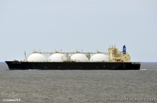
 ARUNIKA JAYA
Current Status
Where is the vessel?
ARUNIKA JAYA is currently in 54 nm NW of Puerto Princesa, based on AIS data received about 7h ago.
Latest AIS update:
Current position: 10.43423° N, 118.14114° E (54 nm NW of Puerto Princesa)
Average speed (last 7 days): Loading…
Average speed (last 30 days): Loading…
Vessel profile: ARUNIKA JAYA is a Lng Tanker with dimensions m x m.
This page combines live AIS, route history, probable destination signals, nearby traffic, and port activity for practical vessel monitoring.
The current position of vessel ARUNIKA JAYA is 10.43423 lat / 118.14114 lng. Updated: 2026-05-14 16:30:23 UTCNearest reference points:
- 70 nm W of Puerto Princesa
- 43 nm W of Malampaya
- 65 nm NW of Malampaya
Currently sailing under the flag of Indonesia ![]()
Details:
Live Vessel ARUNIKA JAYA Analytics (details, animations, etc.)
Recent AIS points (UTC):
2026-05-14 16:30:23 UTC · 10.43423, 118.14114 · SOG 13.8 kn · COG 23°2026-05-14 16:30:23 UTC · 10.43423, 118.14114 · SOG 13.8 kn · COG 23°
2026-05-14 16:30:23 UTC · 10.43423, 118.14114 · SOG 13.8 kn · COG 23°
2026-05-14 16:30:23 UTC · 10.43423, 118.14114 · SOG 13.8 kn · COG 23°