 vesseltracker.com
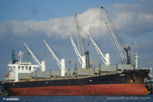
 HI 03
HI 03
Current Status
Where is the vessel?
HI 03 is currently in Near TANJUNG PEMANCINGAN, based on AIS data received less than 1h ago.
Latest AIS update:
Current position: 3.21788° S, 116.33725° E (Near TANJUNG PEMANCINGAN)
Average speed (last 7 days): Loading…
Average speed (last 30 days): Loading…
Vessel profile: HI 03 is a Bulk Carrier with dimensions 32m x 190m.
This page combines live AIS, route history, probable destination signals, nearby traffic, and port activity for practical vessel monitoring.
The current position of vessel HI 03 is -3.21788 lat / 116.33725 lng. Updated: 2026-04-29 18:18:41 UTCNearest reference points:
- Near TANJUNG PEMANCINGAN
- 12 nm SE of Bunati
- Near Bunati
Currently sailing under the flag of Indonesia ![]()
HI 03 built in 2002 year
Deadweight:
52479 tDetails:
Live Vessel HI 03 Analytics (details, animations, etc.)
Recent AIS points (UTC):
2026-04-29 11:37:40 UTC · -3.21930, 116.33945 · SOG 0 kn · COG 353°2026-04-29 16:12:39 UTC · -3.21878, 116.33763 · SOG 0 kn · COG 58°
2026-04-29 16:54:24 UTC · -3.21843, 116.33733 · SOG 0 kn · COG 72°
2026-04-29 18:18:41 UTC · -3.21788, 116.33725 · SOG 0 kn · COG 91°